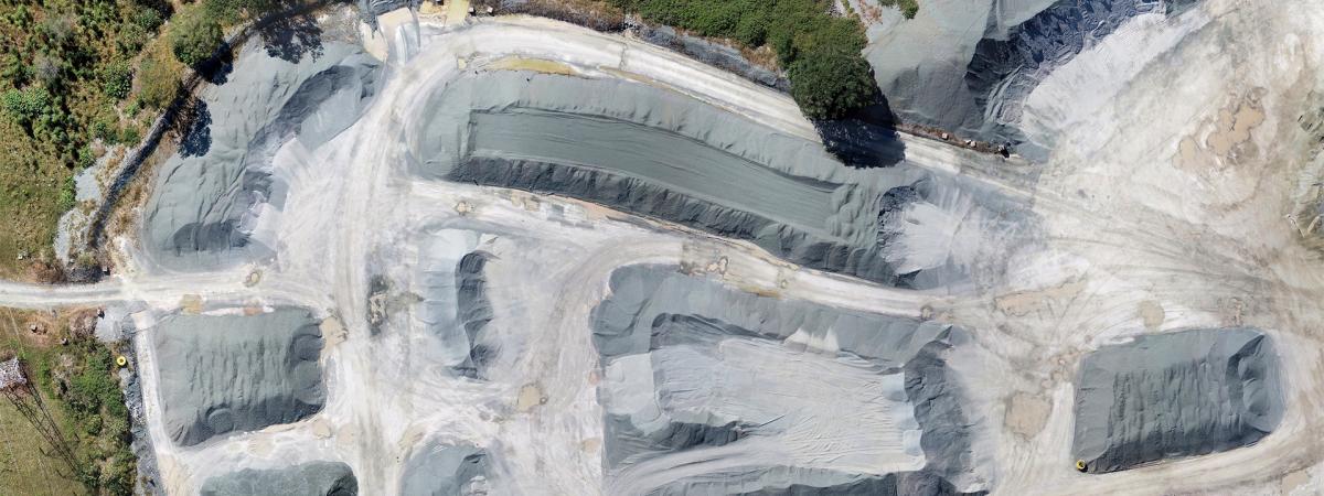
Petrie Quarry is located approximately 30kms northwest of Brisbane and 13kms northwest of Petrie on Dayboro Road and is within the Moreton Bay Regional Council.
The locality was initially developed for predominantly rural grazing purposes, before being rapidly re-developed into smaller acreage allotments and residential subdivisions. This redevelopment was largely due to improved road transport, which provided a fast and convenient means of access to the ever expanding suburban areas based around the northern satellite business centre of Strathpine.
The quarry is situated on a 134 hectare freehold property, of which only around 35 hectares has been disturbed for quarry pit and infrastructure development. The balance of the site is currently used as buffer zone, part of which has been enhanced with extensive tree planting.
Boral Resources, through its then subsidiary, BMG Resources, acquired the freehold of the site in 1986. Following the then Pine Rivers Shire Council (PRSC) consent approval in February 1990, a detailed engineering design was undertaken, which covered the water management system, plant and stockpile area, onsite road works and upgrades to Dayboro Road infrastructure / services and the truck wheel wash. Petrie Quarry is sited within the Rocksberg Greenstone Belt, which is late Devonian to early Carboniferous in age (330-400 million years old). The greenstone formed as a series of basaltic units which have since been regionally metamorphosed. The greenstone produces strong, durable products suitable for use as concrete, asphalt aggregate, and as road base. The transport of materials from the eastern quarry is onto Dunlop Lane and then the Dayboro Road. Transport from the western quarry is directly onto the Dayboro Road.
Petrie Quarry Liaison Group
The first Petrie Quarry Liaison Group meeting was held in August 2005 at the Heritage Museum located at the North Pine Country Park, Dayboro Road.
Minutes of Petrie Quarry Liaison Group meetings
Community Engagement Activities at Petrie quarry started in 2002 and have involved the local CREEC Centre, - Pine Rivers Fish Management Association, local Heritage Museum, Koala Fodder Plantation and a Management Committee, and Conservation Volunteers Australia.
Major achievements of the Petrie Community Liaison Group include:
- installation of speed radar signs
- road maintenance
- Transport Code of Conduct
- Koala Fodder Plantation
- Koala Fence and Underpass
Transport Code of Conduct
Koala Fodder Plantations on Quarry Buffer Land
The first koala fodder plantation on Petrie quarry buffer land was created to provide local koala carers associated with the Koala Action Pine Rivers and Moreton Bay Koala Rescue with feed for injured and/or orphaned koalas in the area.
Excess koala food from the plantation supplies the Australian Wildlife Hospital and koalas housed at Australia Zoo.
Another benefit is that leaf (naturally grown koala food) is not being taken from the bush ensuring our wild koalas do not lose out by having their food trees harvested.
The Launch of the Koala Fodder Plantation
The launch of the koala fodder plantation was one of various initiatives at the Petrie Quarry which commenced in May 2002.
Hon Peter Dutton MP and Councillor Graeme Ashworth from the then Pine Rivers Shire Council (PRSC) officially launched the koala fodder plantation. Vanda Grabowski of KAPR assisted with her extensive knowledge of koalas and their feeding requirements.
The Pine Rivers community teamed up with local koala care organisations and planted a large eucalypt nursery in the grounds of the Petrie Quarry. Around 1200 eucalypts donated by Council were planted. 65 volunteers participated in this initial planting and launch.
New Koala Fodder Plantation
In 2011, Boral engaged a consultant 'Naturecall' to assist in establishing a new koala fodder plantation so the existing plantation can eventually be phased out and can become part of the natural habitat within the quarry buffer land. Boral asked for input from the Koala Fodder Plantation Committee members (including koala carers and Australia Zoo) in the planning of this new plantation, to ensure the new plantation meets everyone's needs and includes improvements.
Powerlink Easement
Powerlink granted Boral a co-use of the power easement to establish a new koala fodder plantation. The intention for this project is to replace the existing fodder plantation in a new area to increase the amount of fodder.
Boral will maintain the fodder trees at all times to a height prescribed by Powerlink, ensuring a save environment within the power easement.
Boral believes that the co-use of the easement for a Koala fodder plantation is an appropriate and beneficial use of land, which would otherwise remain vacant and require maintenance by Powerlink.
Koala Fence and Underpass
In September 2009, Boral has implemented Koala Safety initiatives by building koala exclusion fencing and furnishing an underpass under Dayboro Road, where it crosses with a wildlife corridor. The fence stretches approximately 1km on both sides of the road, directing native fauna towards the underpass, allowing safe crossing to the other side.
Rehabilitation of the Land
A large proportion of the site was cleared many years ago for grazing purposes. Boral developed a comprehensive landscape and rehabilitation plan to enhance existing wooded areas and reafforest cleared areas.
The main aims of the rehabilitation project include:
- improving native vegetation surrounding the operational areas of the quarry; and
- improving fauna habitat, specifically koala habitat on the site; the koala fodder plantations are part of Boral’s overall rehabilitation strategy for the quarry.
Initial plantings were undertaken as a priority in order to screen the plant and quarry operations from the neighbouring residences and passing traffic on Dayboro and Adsetts Roads.
The landscape and rehabilitation plan was also designed to address the needs of the resident and migrating Koala population, which is widespread throughout the district.
Initial planting was carried out in 1992/3 followed by additional planting of some 14,000 trees following a bush fire in 1994/5.
To date approximately 100,000 trees have been planted over the life of the operation.
Saratoga Breeding Program
Boral in partnership with the Pine Rivers Fish Management Association (PRFMA) commenced a fish-breeding program in 2003. A joint initiative to fish Saratoga under licence and release them in site water management dams at the Petrie Quarry; after breeding was confirmed, social fishing days were introduced to catch the Saratoga and transport them back to Lake Samsonvale for re-stocking purposes."
The Whiteside deposit is located about 13 kilometres west of Petrie, north of Lake Samsonvale - Whiteside Key Resource Area - KRA58. Key Resource Areas (KRAs) are locations across Queensland that have been found to contain important extractive materials such as sand, gravel and rock. These materials are the major ingredients used for building our homes, hospitals, schools and factories, as well as the supporting infrastructure of roads, railways, ports, and water supply systems.
KRA encompasses:
- the extractive resource and on-site processing area;
- the associated transport route, usually a road haulage route;
- a separation area around the resource and processing area and the transport route.
KRAs will be protected from incompatible land uses through the development assessment by ensuring development in the KRA is compatible with the extraction, processing and transport of extractive materials to markets.

